Liquid Assets
Maximizing Greater Des Moines’ rivers for tourism and recreation

PERRY BEEMAN Feb 11, 2016 | 12:00 pm
7 min read time
1,614 wordsArts and Culture, Business Record Insider
Rick Tollakson regularly runs on the Principal Riverwalk in downtown Des Moines. He’s seen how Elkader and Manchester use whitewater courses as recreational draws, and he knows there are people in Des Moines who want the same kind of amenity.
The president and CEO of Hubbell Realty Co. heads a 27-member Des Moines Area Metropolitan Planning Organization task force that wants to make it easier for canoeists, kayakers, bird-watchers, crew teams, boaters and fishing enthusiasts to local waterways, and to improve water quality. The water trails task force now has documented what’s in place now in an interactive map. There you’ll find details and, eventually, information on public meetings to be held as the group considers formal recommendations.
The MPO is coordinating the $150,000 study, paid for by the Iowa Department of Natural Resources. The work will produce what is officially called the Greater Des Moines Water Trails and Greenways Plan.
“It’s huge,” Tollakson said of the potential to turn the waterways into bigger draws. “It’s something we have to get done.”
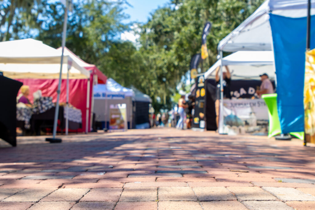
In Greater Des Moines alone, there are 150 miles of rivers, creeks and streams. The task force is taking a closer look at the full potential of the streams that are big enough, and safe enough, to use. There also has been plenty of talk of removing the Center Street and Scott Street dams in downtown Des Moines, where kayakers want a whitewater run.
“The biggest thing I’ve heard about the Center Street dam is, how can we maintain the water level so the crew people can crew downtown?” Tollakson said. “We can move the dam probably about anywhere we want to. If you wanted to create a whitewater rapids, where would you stop and start that? You can keep the water level high all the way through downtown if you want, and create rapids wherever you want.”
Tollakson has heard about the cry, especially from millennials, for a full range of recreational opportunities in Des Moines. The MPO spent the last half of 2015 holding focus groups and polls to see what people want from the Skunk, Des Moines, Raccoon and Middle rivers, for example, and from Beaver and Walnut creeks.
As the initial “State of the Rivers” report developed, 176 people participated in 22 different focus groups. In all, 337 people completed paper and online surveys.
The largest segments of those surveyed — 13 percent — said they consider protecting the rivers as a drinking water source, and participating in walking, jogging and bicycling as the highest priorities. Close behind were protecting wildlife habitat, 12 percent; canoeing and kayaking, 11 percent; and fishing, 10 percent. Other priorities in the single-digit percentages were boating, bird-watching, camping, relaxing, flood protection, tubing, playing and for views from a house.
Tollakson said it has become clear that there are many groups of people interested in using the rivers, from boaters to crew enthusiasts to kayakers. They don’t always have the same goal.
“A lot of people are going to focus on the downtown section,” Tollakson said. “But really I think what we need now, and the heavy lifting of the committee, is what is our vision going to be? ”
“It’s one thing to have a vision, but (we) want to have a vision that looks like it might actually happen,” Tollakson said.
Some projects would be easier than others. One, the task force said, is to come up with signs and mobile apps to make it easier to plan a trip, right down to the attractions one could visit near the river.
“I looked at the Raccoon, and I think there is one small dam, but it could be a fairly easy kayaking route,” Tollakson said. “Same thing with Beaver Creek; from 70th on down, it’s pretty navigable for kayaking. Those two in particular might be fairly easy for that. With Walnut, it’s how do you interact with the creek? Kids could, for a large part of the year, go down and play in the creek, but it’s not big enough for kayaking.”
Tollakson said he knows that boosting river-related recreation would be good for the real estate business, and for businesses that rent kayaks and the like. He’s developing land near both the Raccoon and the Des Moines. Then there’s this: “If there are more kayaking opportunities, then there will be more people to rent you a kayak to go do it.”
The MPO’s water trails team has created an unusually elaborate Web-based look at what is in place now. The interactive map shows the locations of dams, logjams and other quirks of the rivers, in some cases with popout photos. Eventually, it will show how to get from the river to local attractions such as parks, bike trails and perhaps even restaurants. The next step is to come up with a set of recommendations, after people have time to comment on the so-called existing conditions report.
“What is the vision going to be?” Tollakson asked.
Greater Des Moines has had success with long-range visioning. The evidence: The development of the Principal Riverwalk, the development of the East Village, the John and Mary Pappajohn Sculpture Park and the surrounding Western Gateway Park, a rapidly spreading network of recreational trails and bike lanes, and a revamped bus system that caters to bike-and-bus trips and now is looking at special routes offering speedier, trainlike service.
The task force ecommendations could result in a multimillion-dollar effort over two decades, Tollakson said. But what surprised him most, especially outside of downtown Des Moines, is how simple it could be to create easily accessible, well-marked kayaking routes, say, along the Raccoon River from Dallas County to the middle of Des Moines.
“I was most surprised how easy and inexpensive some of this work may be,” Tollakson said in an interview. “I think we have the potential for some pretty easy accesses on the Raccoon River. The website shows you where you can get in.”
Nate Hoogeveen, who works on water trails and dam removals for Iowa Department of Natural Resources, says in another video on the MPO’s site that 14 Iowa dams have been “mitigated” — either just removed or replaced with a rapids — for safety reasons. Often, said Hoogeveen, an avid paddler, the dams serve no purpose in flood control. Tollakson said he’s been unable to determine why the Center Street dam in downtown Des Moines was installed in the first place.
“I don’t get a sense there will be a lot of Army Corps (of Engineers) issues,” Tollakson said. “I think Army Corps is more concerned about controlling flooding up and down the river, and I don’t think those dams have much of anything to do with that.”
Olson said one challenge is “managing the different uses: fishing, kayaking, canoeing. Some of these things can work well together. Others can’t, especially in close proximity.”
“We looked at existing conditions and the potential of what could be done,” Tollakson said. “Then we take this committee of 30 or 40 people and we talk about vision of each of these segments. What would we really like them to see? There are easier ones to tackle first rather than the downtown area, although more people are focused on that.”
Tollakson found himself spending hours zooming in on the offerings and obstacles chronicled up and down the Central Iowa rivers. “We are at the beginning phases,” Tollakson said. “The toughest thing is going to be breaking it down.”
“There are a lot of cool recreation areas right in the middle of a huge metro area. We just haven’t focused on them, and we should,” Tollakson said. “Some of them, it would be pretty easy to come up with something that would be an attraction.
“Kayakers are very passionate. The crew people, the fishing people, the motorboaters are very passionate, but they aren’t a whole lot of people. They want people to get more interested in the rivers and make them an attraction.”
A lot of the funding will come from public sources, Tollakson said. Those local governments already struggle to find cash, so it’s likely this will be a long paddle. “I hate to say it, but it probably takes 20 years,” Tollakson said. “Look at the bike trails. You get it done a segment at a time.”
Key findings: State of the Rivers initial report
Improve access
“We need to improve access to rivers and creeks.That is pretty obvious, but it comes in many ways,” said Gunnar Olson, a spokesman for the Des Moines Area Metropolitan Planning Organization.
Water quality and conservation
“A lot of what we heard was about recreation, but with that, water quality is important to recreation. People aren’t going to use waterways that they perceive as dangerous or dirty,” said Rick Tollakson, chairman of the task force and president and CEO of Hubbell Realty Co. The group talked about preserving the 500-year flood plain, restoring stream banks and tracking natural resources that should be protected.
Coordination among key players
“The waters don’t know political boundaries,” Olson said. Some task force members envision a regional greenways body that would coordinate both water trails and paved recreational trails, guiding development, implementation, marketing, funding and connections among projects. Said the report: “It will be important to document and communicate which parties are responsible for various activities.”
Community engagement
Access to the various programs.
Safety
“We know the dams are a safety issue that will be discussed,” Olson said. Other safety issues include making it easier to get to the river and to nearby attractions, and making sure paramedics are ready for a potentially higher number of calls should accidents pick up because more people are using the rivers.
Trending News